Hurricane Isaac Updates
Sunday, September 2nd, 12:00pm - Mike Hymel reports flooding is still a major problem in Barataria, Louisiana.
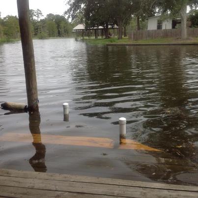
"Entergy can never get here if the water is not pumped down," he explained. "This pump is a joke. Notice the duct tape and puny size. They have so many lame excuses, but what it comes down to is we're in the armpit of Jefferson Parish. We don't have the large voting base. We pay just as much or more in taxes and this is what we get." (Left - pump near Mike Hymel's home in Barataria, LA)
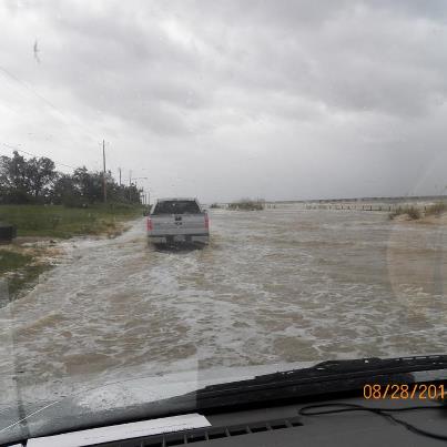
Power can't be safely restored until the standing water is gone. The water level in the bayou has gone down, but a large amount of standing water is still trapped in the community. With adequate equipment, the water could be pumped out quickly and power could be restored, a necessity for clean-up. Mike estimates the water dropped only 2 inches in the past 12 hours. The water is more than 2 feet deep in front of his house and deeper further down the road.
Mike feels it all comes down to proper planning and preparedness. "Officials should have known, should have been prepared - we've had enough storms to know to bring in adequate pumps and to be prepared. Everybody knows we're outside the levee system. But all we get are lame excuses and constant bumbling."
(Right - flood waters on Privateer Blvd, Barataria, LA. Photo by Penny Wilgerodt)
Saturday, September 1st , 4:30pm - In East Plaquemines Parish, Louisiana Oysterman's Association President Byron Encalade says some Plaquemines Parish residents who were evacuated during the storm are staying in deplorable conditions in Shreveport, LA.
"They were assured they'd have decent facilities and now they're up there using overflowing Port-O-Lets and outdoor showers. The conditions are anything but decent," Encalade said during a recent call.
Encalade was on the road, searching for apartments or any type of housing that would allow residents to be closer to their homes. Shreveport is more than seven hours from Plaquemines Parish
It is unclear why residents were evacuated so far from their homes or if transportation will be made available to help them return home.
"I'm tired of this foolishness and I'm tired of this waste," Encalade exclaimed. "We learned after Katrina not to evacuate people this far from their homes - that's too far, they can't handle their business, they can't get back to their homes, nothing. There's Road Home money still sitting here from Katrina, Rita, Gustav and (officials are) playing games. My people's civil rights are being violated and we're not going to take it anymore. "
Saturday, September 1st , 1:50pm - Plaquemines Parish residents who were told by officials yesterday they'd be able to return to their homes today are being turned back once again. Residents had been promised they could return on Thursday and Friday, but were turned away then, too.
"It's frustrating," said Buras resident Kindra Arnesen, "They got all kinds of people going through our stuff with limited sheriffs. I want to go home...it's not just storm damage, it's damage from letting the water sit, too. We just want to go home."
Looting has already been reported in the Buras and Belle Chasse.
Saturday, September 1st , 12:30pm - Bridge the Gulf contributor Cherri Foytlin, who is in Belle Chasse, Louisiana reports Plaquemines Parish officials have confirmed a large oil spill on the west side of Belle Chasse. Clean-up efforts have begun. We'll post more information as soon as it becomes available.
Saturday, September 1st , 11:00am - As Gulf Coast residents continue to assess damages and begin cleanup, we've received several reports from local beaches.
Bay St. Louis, MS - Charles Taylor reports finding blocked drainage canals, dead nutria and brown foam that he suspects could be emulsified oil.
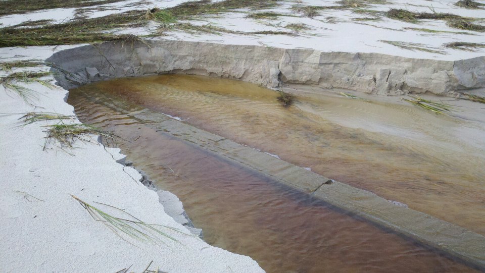 Sand brought in since the BP Oil Disaster blocks a drainage canal in Bay St. Louis, MS. Layers of what appear to be residual oil from the BP disaster can be seen in the background near the sand "cliff". (photo by Charles Taylor)
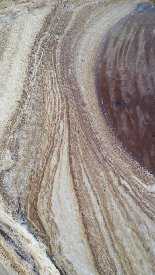 Brown foamy rings at the beach in Bay St. Louis, MS (photo by Charles Taylor)
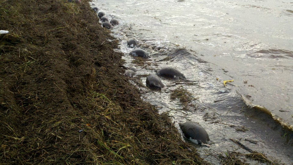
Dead nutria line the Bay St. Louis Beach (photo by Charles Taylor)
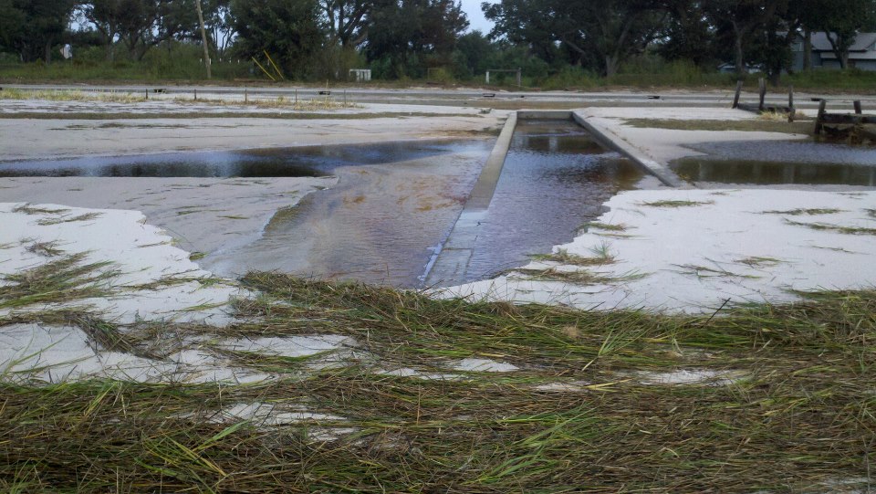
Sand blocking a drainage canal in Bay St. Louis, MS (photo by Charles Taylor)
Gulfport, MS - Laurel Lockamy reports Harrison County has closed their beaches in order to determine if they are contaminated by BP's crude oil. But she wants to know why there are no signs posted to say the beach is closed and worries for the safety and health of unsuspecting tourists who may be headed to the coast for Labor Day. She's frustrated that she's gotten no response when questioning local officials.

Looks and smells like oil on the beach in Gulfport (photo by Laurel Lockamy)
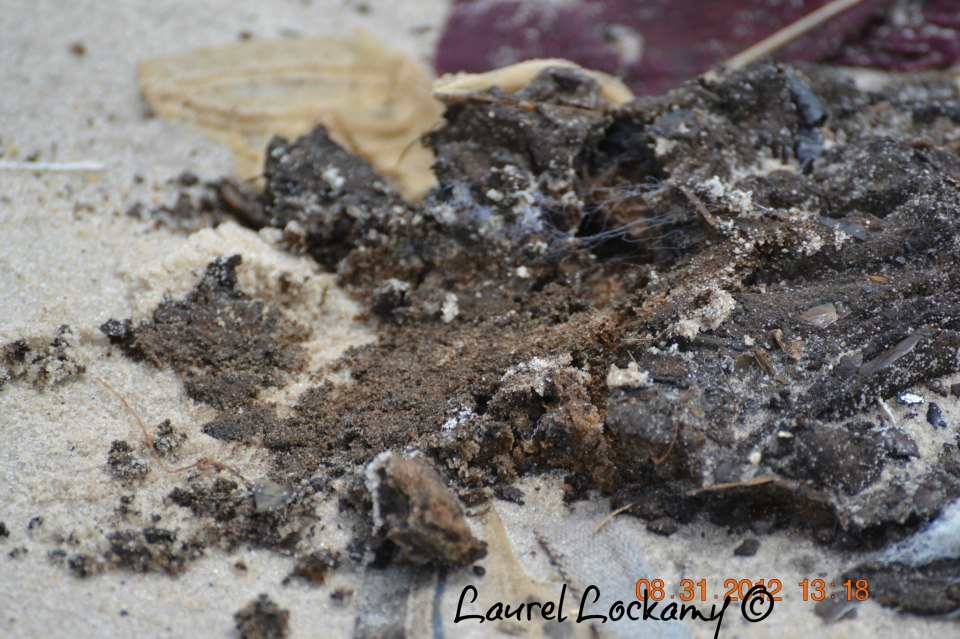
On the beach in Gulfport, MS (photo credit Laurel Lockamy)
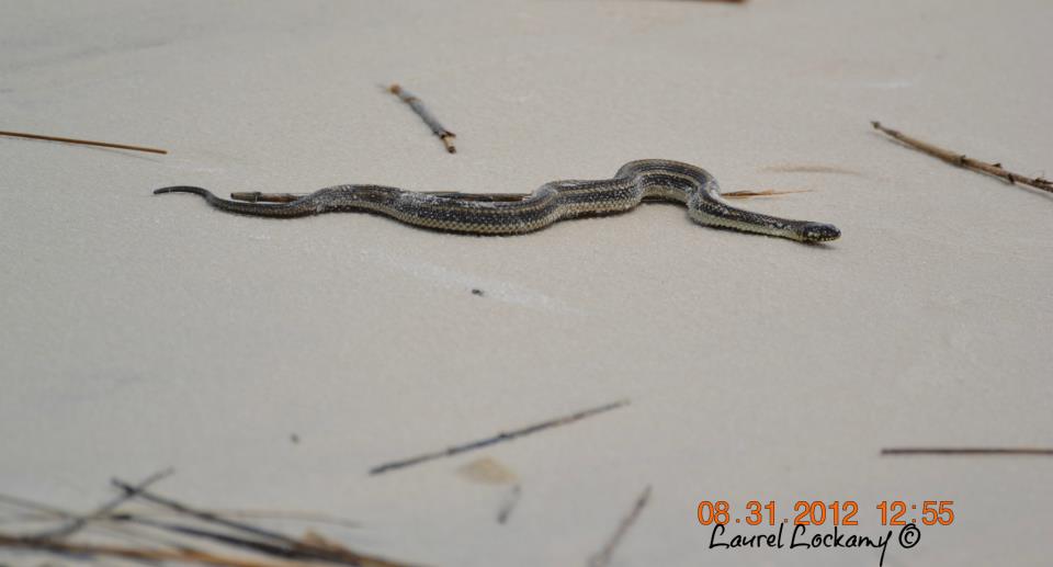 This guy likely washed out of the marsh grass as the water receded
(photo by Laurel Lockamy)
Pensacola, FL - Kim Schultz reports finding what looks like BP crude oil. She's collected samples to be tested will let us know when she receives the results.

Tarball on the quiet water/sound side of Pensacola Beach (photo by Kim Schultz)
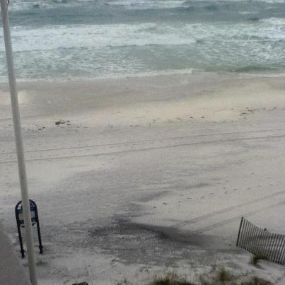
Dark streaks on Pensacola Beach after Issac (photo by Kim Schultz)
***********
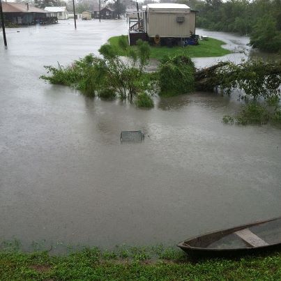
8:49 PM, Thursday, August 30th - Severe flooding has innundated Jean Lafitte and Barataria, Louisiana throughout the course of the storm. Mayor Tim Kerner has asked that residents not return until Sunday, so the town has time to clean up (Times-Picayune). Michelle Chauncy is weathering the floods in Barataria, and shared the above picture via Facebook, with the caption "the view out my back door."
Officials are pleased that New Orleans' improved post-Katrina levee system prevented the city from facing catastrophic flooding. Yet Kerner says it made flooding worse in Jean Lafitte. Other communities outside of new the federal levee system faced dangerous flooding as well, such as Plaquemines Parish, where non-federal levee was overtopped on Tuesday. Officials say they will cut a hole in that levee as soon at it is safe, to drain the area.
Mark Fayard shared this picture this afternoon, from near the Silver Slipper Casino in Bay St. Louis, Mississippi.
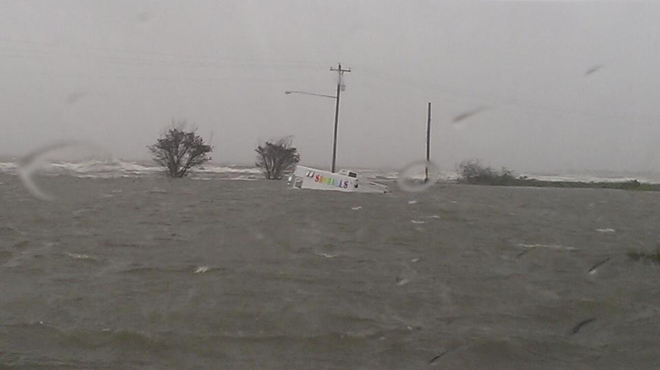
Bridge The Gulf volunteer Karen Savage reports from her check-ins with Mississippi residents that they had at least three tornados on the ground yesterday, one resulted in a couple people having to be pulled out of the debris (although without major injuries). Here's more from the Sun-Herald.
Sharon Hanshaw reported from Biloxi, Mississippi a little after noon: "We are still standing, uncertainty ahead. Lots of trees down, curfew still in affect until 7:00 p.m. Expected more rain and tornadoes. Mandatory evacuation in Creole area of Moss Point. Tornadoes has demolished 2 homes thus far in Gulfport."
Coastal Women for Change, where Sharon is Executive Director, is urging residents to avoid contact with BP crude oil and/or dispersants that come ashore. Speaking of BP, the oil giant responsible for the 2010 oil disaster in the Gulf of Mexico is reportedly donating $1 million to the American Red Cross and Salvation Army to support Isaac relief efforts.
Kaitlin Truong, of Asian Americans for Change, shared the following picture via Facebook, from Biloxi, Mississippi: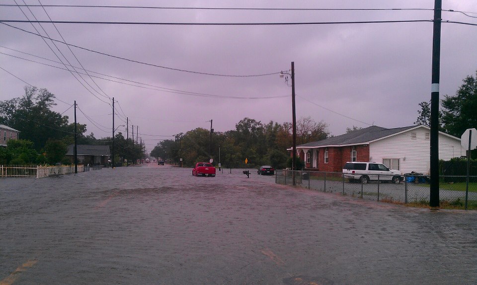
Zack Carter of South Bay Communities Alliance and the Alabama Fisheries Copperative reports that tornadoes are touching-down near Bayou La Batre, Alabama, there is still a lot of flooding, and the residents of the Safe Harbor housing development are hunkering down to stay safe.
Cherri Foytlin updated on Facebook: "In LaPlace, [Louisiana] phone spotty, so no mobile uploads. Lots of water... Lots of damage, still raining. Pics when I can." Rescue operations were underway in LaPlace earlier today, after a storm surge early this morning flooded communities in St. John the Baptist Parish (Times-Picayune).
11:57 AM, Thursday, August 30th - A mandatory evacuation is in effect for about 50,000 people along the Tangipahoa River in Louisiana. Officials fear a dam on the river will fail. Officials in Pike County Mississippi, where the dam is located, advise that people evacuate, but have not made it mandatory. (Clarion-Ledger)
There is major flooding in Slidell, Louisiana. Flash flooding in the Olde Towne area prompted evacuation. (KHOU)
In St. John the Baptist Parish, Louisiana before dawn, about 3,000 people were forced to evacuate their homes due to storm surges from Lake Pontchartrain and Lake Maurepas. (Reuters)
Search and rescue prompted by those storm surges continues in LaPlace, Louisiana. (Times-Picayune)
Mandatory evacuation was ordered at 10am for Moss Point, Missisisippi. (Mississippi Emergency Management Agency)
Charles Taylor shared photographs on Facebook of tar and "nasty foam" on the beach in of Bay Saint Louis, Mississippi this morning. PLEASE NOTE: DO NOT HANDLE TAR AND OIL. The Louisiana Environmental Action Network and Gulf Coast Fund issued an advisory on Tuesday morning warning people to do everything they can to avoid exposure to BP's oil and disperant. If you do encounter oil and or dispersant remnants, and can safely document it, the Gulf Coast Fund is asking people to report the location, a description and, if possible, a photo of the re-surfaced oil (email joshua@gulfcoastfund.org or call 504-522-2423).
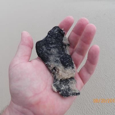
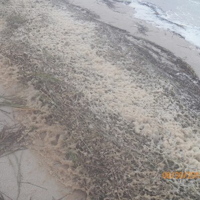
Governor Phil Bryant of Mississippi reported on his Facebook page, "This morning I inspected beaches in Gulfport with the Mississippi Department of Environmental Quality. The agency will examine any oil or oiled debris to determine if BP bears responsibility."
The National Hurricane Center says Isaac is weakening as it moves inland. But flooding continues to threaten areas of Mississippi and Louisiana.
"By mid-morning Thursday, Louisiana's Public Service Commission said 903,000 homes and businesses around the state -- about 47 percent of all customers -- are without power." (CBS)
10:47 AM, Thursday, August 30th - BREAKING: Mandatory evacuation for those that live along Tangipahoa River from Kentwood to Robert. A dam broke. This includes 50,000-60,000 people. Tangipahoa Parish, Louisiana, President Gordon Burgess is saying there's a 90 minute time frame to get out safely. (WWLTV)
11:10 PM, Wednesday, August 29th - Water levels still rising tonight in Southeast Louisiana. The road to Lafitte and Barataria is closed to prepare for further flooding, and a storm surge update from the Army Corps of Engineers includes: "there is a 100-foot vessel that is loose in the Barataria waterway."
8:17 PM, Wednesday, August 29th - Isaac has been downgraded to a tropical storm, but it will continue to dump rain and storm surge across southern Louisiana and Mississippi tonight and into tomorrow. Electricity has gone out in over 817,000 homes and businesses in Louisiana, Mississippi, Alabama, Florida, Texas and Arkansas. (CNN)
From Brenda Dardar Robichaux, Raceland, Louisiana -12:00 noon CST
"Wind & rain all night. Really kicking @ around 5 am. No electricity since last night. Porch siding down & tree branches is the only damage. Very lucky with all that heavy wind last night. Light wind & rain right now but waiting for the back half of the hurricane to hit us next. "
From Cherri Foytlin, Rayne Louisiana - 1:00 PM CST:
"Still good. Winds but little rain. They say we got a few more hours. Soon as it passes me, I'm heading 90 south to see what I can do to document.. Probably tomorrow, no school anyway, and I'm tired of being cooped up - not made for this."
Cherri also shared this pic of price gouging from a friend near Rayne, Louisiana:
Reverend Tyronne Edwards of Phoenix, LA reported around 1:45 CST via phone that he and his mother evacuated to New Orleans and are safe. Byron Encalade (of the Louisiana Oyterman's Association) also got out safely during the mandatory evacuation. A lot of east bank is underwater. Reverend Edwards heard about the possibility of a deliberate levee breach in Plaquemines Parish, which would not impact Pointe a la hache, Phoenix and Davent areas of Plaquemines Parish.
The Times-Picayune reports that as soon as conditions allow, likely tomorrow, the State of Louisiana will cut a hole in the levee in order to allow water in Plaquemines Parish to drain out to the Gulf. The "deliberate breach" will be in the same 18-mile levee that was overtopped by the storm surge earlier today, flooding an estimated 800 homes. More than 75 people have been rescued from the area. The Louisiana National Guard says they got everyone out and there were no major injuries. (AP)
Nearly 50 people have been rescued in coastal Mississippi as well, said MS Governor Phil Bryant (CNN)
A levee breach was reported near Madisonville, Louisiana, on the north shore of Lake Pontchartrain, and search and rescue is underway, reports the Times-Picayune.
Laurie Gayle Lambert of Waveland reports on Facebook that there was a tornado in Gulfport, Mississippi.
New Orleans resident/Tulane Professor/MSNBC host Melissa Harris-Perry tweeted a photo of the New Orleans house she and her husband James Perry just bought, destroyed by Isaac: "Feeling sad…. All safe. House was vacant except for my dreams. pic.twitter.com/h62AkGPB"
More details from the National Hurricane Center's 7pm CT advisory:
"EVEN THOUGH ISAAC IS NO LONGER A HURRICANE...LIFE-THREATENING HAZARDS FROM STORM SURGE AND INLAND FLOODING ARE STILL OCCURRING."
The NHC reported rainfall estimates remain 7-14 inches, with an unofficial total of 18.35 inches reported in Gretna, Louisiana.
This blog post from Drew Landry includes resources for coastal residents weathering the storm.
Finally, here is a clip from yesterday's morning's Democracy Now, when reporter and Bridge The Gulf contributor Brentin Mock spoke about the anticipated impacts of Isaac on mental health and on fishing communities:
*****
1:40 PM, Wednesday, August 29th - Video shot by Charles Taylor in Bay Saint Louis, MS this morning at 10 am at South Beach Blvd.
Michael Roberts in Barataria, Louisiana reported at 11:20CST.: "Still in the heart of the storm, pretty bad and getting worse, water is raising faster than I've ever seen in all my life"
Of particular concern is the Bayou Corne/Grand Bayou area in Assumption Parish, where Isaac will encounter a 400-foot wide sinkhole that opened earlier this month. Here's an update from the Assumption Parish blog, shared by John Achee:
"12:06pm - LATEST UPDATE: The forecast has again shifted track bringing the eye through the middle of Assumption parish towards the Labadieville area. Isaac is currently a Category 1 hurricane. At approximately 2:00 p.m., be prepared for sustained winds of 70 mph with gusts up to 85 mph. The storm is expected to take the eye of the storm FIVE HOURS to enter and exit Assumption. It could be before 7:00 p.m. where we are still experiencing hurricane force winds and by 11:00 pm that we are experiencing tropical storm force winds. We cannot express the curfew enough. Please refrain from riding and sightseeing as there are trees and power lines reported down on area roadways. This is for your own safety. The OEP remains open and staffed – the number here is 985-369-7386."
Tara Cummings, in Old Metairie, Louisiana shared an update via our Facebook page, ending with advice for those weathering the storm:
"14 ft flooding in parts of Plaquemines parish. Eastern part. Belle Chasse ok just no power. Friend Uptown on Magazine no power since 7pm yesterday. Downed power lines and trees. Old Metairie off Metairie road where I am has power. Neighbors massive pecan tree fell though, 5 ft from my bedroom window. Terrytown no power. Metarie Rd has downed trees and 1 downed power line down at the end by Severn/Airline….
"Sewer systems strained; Infrastructure strained so if no power, follow west coast conservation method: if it's yellow let it mellow. If it's brown, flush it down."
Bridge The Gulf and Gulf Coast Fund volunteer Karen Savage, who has been receiving email from across the Coast and monitoring online social networks, reports, "The consistent message from folks across the coast is this storm seems much stronger than a Cat 1 and the slow movement is only compounding all issues."
Curfews are in effect across the Gulf Coast, in much of Southeast Louisiana, New Orleans, and coastal Mississippi.
The National Hurricane Center's noon CT advisory reported that the storm was 10 miles northwest of Houma, Louisiana and 45 miles west of New Orleans. Isaac remains a Category One Hurricane and is moving at 6 miles per hour. Hurricane Isaac is still projected to produce total rainfall amounts of 7 to 14 inches.
Storm surge observed by NHC: 8 feet in Shell Beach, near New Orleans, Louisiana, and 8 feet in Waveland, Mississippi.
Storm surge projected by NHC:
* MISSISSIPPI AND SOUTHEASTERN LOUISIANA...6 TO 12 FT
* ALABAMA...3 TO 6 FT
* SOUTH-CENTRAL LOUISIANA...3 TO 6 FT
* FLORIDA PANHANDLE AND APALACHEE BAY...2 TO 4 FT
Tornado watches and warnings are also in effect in coastal Louisiana and Mississippi.
******
10:05 AM, Wednesday, August 29th - Terese Collins of Biloxi, Mississippi shows the rising water outside her home. Video taken this morning around 9 am.
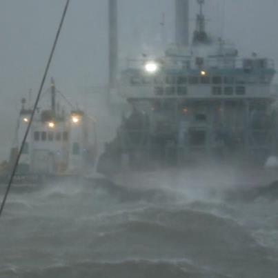
9:55 AM, Wednesday, August 29th - This picture was taken by Lee Walker from the wheel house of a supply vessel. They're docked at Port Fourchon to weather the storm. Special thanks to Lee's sister, Michele Walker-Harmon, for sending us the picture.
********
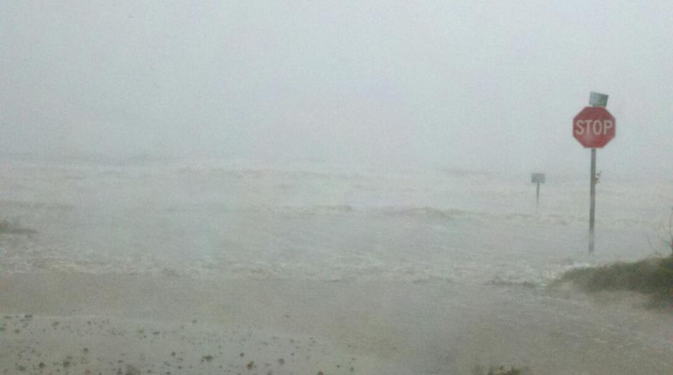
9:30 AM, Wednesday, August 29th - Above is a picture from Charles Taylor, taken a few minutes ago on South Beach Blvd. in Bay St. Louis, MS.
********
8:40 AM, Wednesday, August 29th - Here's a report from Charles Taylor in Bay St. Louis, Mississippi, via Facebook:
"Its hammering us over here in Bay St. Louis too...
5:30am and it is blowing hard out there. Rain blowing sideways, gusts bending the pines over. Feels like its getting a little stronger. Guess we aren't working today either! And still have power! We should have lost it hours ago."
450,000 southeast Louisiana homes and businesses without power, according to Entergy (as of 6:30 AM CT).
18 miles of Levee overtopped in Plaquemines Parish.
National Hurricane Center's 6 am update reports that Category One Isaac is moving over Louisiana and Mississippi at 6 MPH.
Storm surge expected:
* MISSISSIPPI AND SOUTHEASTERN LOUISIANA...6 TO 12 FT
* ALABAMA...3 TO 6 FT
* SOUTH-CENTRAL LOUISIANA...3 TO 6 FT
* FLORIDA PANHANDLE AND APALACHEE BAY...2 TO 4 FT
********
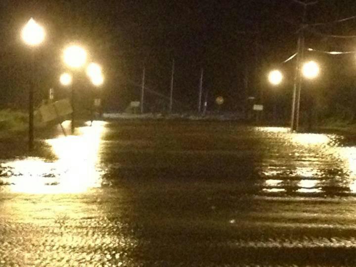
12:20 AM, Wednesday, August 19th - Above is a pic taken in Waveland, Mississippi around 10:30 pm, by Bridge The Gulf contributor Laurie Gayle Lambert.
"237,000 homes and businesses in southeastern Louisiana have been left without power" - New Orleans Times-Picayune
Channel 15 in Mobile, AL reports 5,800 without power in Mobile County, 1,400 without power in Baldwin County, AL, and 900 without power in Escambia County, Florida. (The Mobile Press-Register is reporting close, but slightly different numbers.) Crews are working to restore power in Alabama, as winds are not strong enough to make the conditions unsafe, but in southeast Louisiana officials say the power will remain off until the storm passes (CNN).
Over on our Facebook page, we're hearing from folks who still have electricity - in the New Orleans area (Fairgrounds neighborhood of MidCity, Uptown, Old Metairie); Waveland, Mississippi; and the Alabama coast. And one Facebook friend told us Isaac ripped through the roof of Billy Nungesser, President of Plaquemines Parish.
The Gulf Coast Fund and Louisiana Environmental Action Network warned coastal residents to avoid hazardous oil and dispersant from the 2010 BP oil disaster, stirred up and deposited onshore by Isaac. Louisiana official Garret Graves also warned of the threat to human health this oil could cause, and blamed BP for not cleaning it up.
Mayor Mitch Landrieu says the worst of the storm will hit New Orleans Wednesday morning.
Hurricane Isaac, still a Category One, is moving slowly (8 mile per hour) and is expected to produce 7 - 14 inches of rainfall, according to the National Hurricane Center (NHC)
National Hurricane Center also reported real and projected storm surges, as of Midnight:
Observed surges:
11 feet in Shell Beach, outside New Orleans
6.9 feet in Waveland, Mississippi
Projected surges (if peak surge happens at time of high tide):
* MISSISSIPPI AND SOUTHEASTERN LOUISIANA...6 TO 12 FT
* ALABAMA...3 TO 6 FT
* SOUTH-CENTRAL LOUISIANA...3 TO 6 FT
* FLORIDA PANHANDLE AND APALACHEE BAY...2 TO 4 FT
* REMAINDER OF FLORIDA WEST COAST...1 TO 3 FT
The next update from the National Hurricane Center comes out at 2 am, here.
Thanks to everyone who has kept us updated in the midst of the storm. You can add updates in the comments section here, or on Facebook, Twitter, Tumblr, and at bridgethegulfproject@gmail.com (pics and videos welcome). If you lose power or don't have internet access, you can call Joshua with our partner Gulf Coast Fund at 504-522-2423.
9:25 PM CT, Tuesday, August 28th - Hurricane Isaac made landfall this evening in Plaquemines Parish, Louisiana as a Category 1 storm. Flooding, strong winds, and widespread power outages across the Gulf Coast have begun. The Hurricane is over 200 miles wide, and is affecting the Gulf Coast from Louisiana, across Mississippi and Alabama, to the Florida panhandle.
Where are you? What are you seeing and experiencing? Please keep us and each other updated in the comments section. You can also contact us (including sharing pictures and video) via Facebook, Twitter, Tumblr, and at bridgethegulfproject@gmail.com. If you lose power or don't have internet access, you can call Joshua with our partner Gulf Coast Fund at 504-522-2423.
7:00 PM CT, Tuesday, August 28th - Here are a couple of photos we've seen on Facebook today:
Waveland, Mississippi (photo by Charles Taylor).
Tillman's Corner, Alabama (west of Mobile Bay – photo by Kathy Adams)